
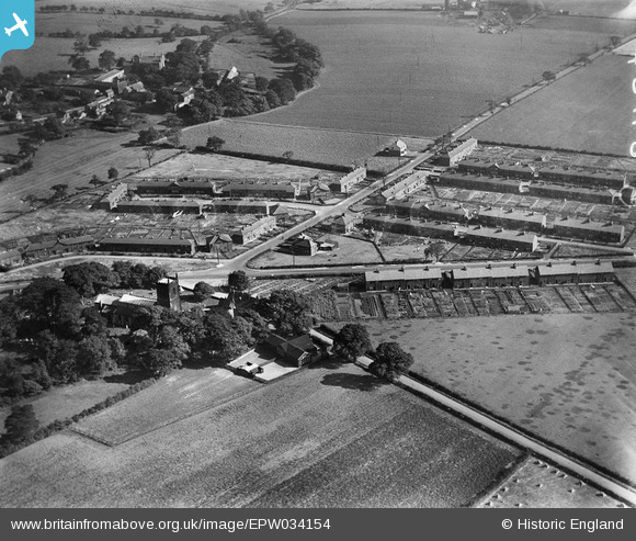
EPW034154 ENGLAND (1930). St Mary's Church, Astley Lane and environs, Swillington, 1930
© Copyright OpenStreetMap contributors and licensed by the OpenStreetMap Foundation. 2025. Cartography is licensed as CC BY-SA.
Nearby Images (3)
EPW034154

EPW034156

EPW034157

Details
| Title | [EPW034154] St Mary's Church, Astley Lane and environs, Swillington, 1930 |
| Reference | EPW034154 |
| Date | July-1930 |
| Link | |
| Place name | SWILLINGTON |
| Parish | SWILLINGTON |
| District | |
| Country | ENGLAND |
| Easting / Northing | 438490, 430353 |
| Longitude / Latitude | -1.415994890999, 53.767880677441 |
| National Grid Reference | SE385304 |
Pins

Class31 |
Sunday 8th of September 2013 08:44:37 AM | |
There are further details on the memorial at www.ukniwm.org.uk/server/show/conMemorial.52763/fromUkniwmSearch/1. |

melgibbs |
Wednesday 1st of January 2014 04:43:34 PM |
|
Class31 |
Sunday 8th of September 2013 08:44:09 AM | |
|
Class31 |
Sunday 8th of September 2013 08:37:24 AM | |
|
Class31 |
Sunday 8th of September 2013 08:36:32 AM | |
|
Class31 |
Sunday 8th of September 2013 08:36:04 AM | |
|
Class31 |
Sunday 8th of September 2013 08:35:45 AM | |
|
Class31 |
Sunday 8th of September 2013 08:30:21 AM | |
|
Class31 |
Sunday 8th of September 2013 08:28:26 AM |