
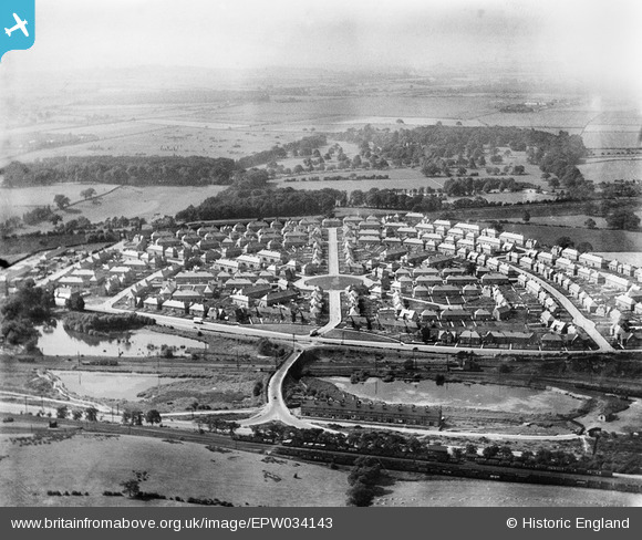
EPW034143 ENGLAND (1930). The Bulwell Hall Estate, Bulwell, from the east, 1930
© Copyright OpenStreetMap contributors and licensed by the OpenStreetMap Foundation. 2026. Cartography is licensed as CC BY-SA.
Nearby Images (14)
EPW034143

EPW034136

EPW034141

EPW034142

EPW034140

EPW020739

EPW034138

EPW034139

EAW038725

EPW020738

EPW034137

EPW034149

EPW020748

EPW034146

Details
| Title | [EPW034143] The Bulwell Hall Estate, Bulwell, from the east, 1930 |
| Reference | EPW034143 |
| Date | July-1930 |
| Link | |
| Place name | BULWELL |
| Parish | |
| District | |
| Country | ENGLAND |
| Easting / Northing | 454602, 346654 |
| Longitude / Latitude | -1.1860340751963, 53.014095242085 |
| National Grid Reference | SK546467 |
Pins
Be the first to add a comment to this image!