
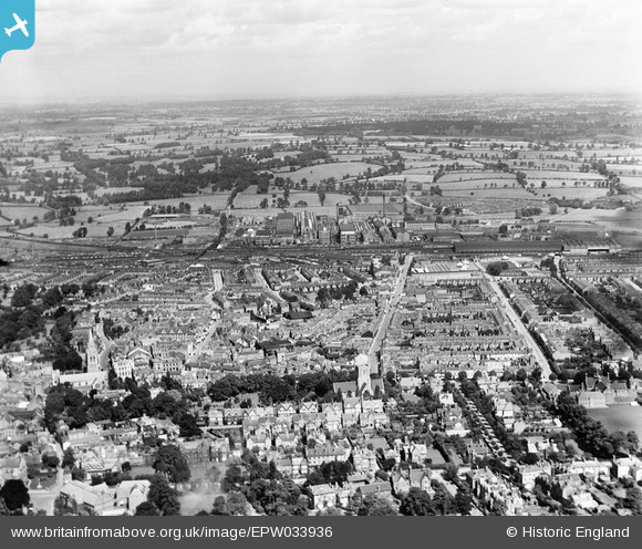
EPW033936 ENGLAND (1930). The town centre, Rugby, from the south, 1930
© Copyright OpenStreetMap contributors and licensed by the OpenStreetMap Foundation. 2026. Cartography is licensed as CC BY-SA.
Nearby Images (6)
EPW033936

EPW021018

EPW010530

EPW033933

EPW012039

EAW006310

Details
| Title | [EPW033936] The town centre, Rugby, from the south, 1930 |
| Reference | EPW033936 |
| Date | July-1930 |
| Link | |
| Place name | RUGBY |
| Parish | |
| District | |
| Country | ENGLAND |
| Easting / Northing | 450560, 275113 |
| Longitude / Latitude | -1.2572790569027, 52.371344704842 |
| National Grid Reference | SP506751 |


