
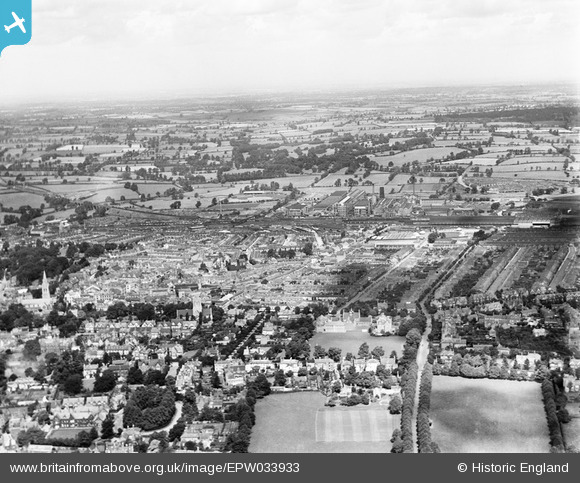
EPW033933 ENGLAND (1930). The town centre, Rugby, from the south, 1930
© Copyright OpenStreetMap contributors and licensed by the OpenStreetMap Foundation. 2026. Cartography is licensed as CC BY-SA.
Nearby Images (5)
EPW033933

EPW021014

EPW037863

EPW033936

EPW021018

Details
| Title | [EPW033933] The town centre, Rugby, from the south, 1930 |
| Reference | EPW033933 |
| Date | July-1930 |
| Link | |
| Place name | RUGBY |
| Parish | |
| District | |
| Country | ENGLAND |
| Easting / Northing | 450729, 274979 |
| Longitude / Latitude | -1.254816967704, 52.370124363934 |
| National Grid Reference | SP507750 |
Pins

Class31 |
Tuesday 5th of May 2015 05:38:49 PM | |

Philip |
Monday 1st of December 2014 07:23:06 PM | |
|
Philip |
Monday 1st of December 2014 07:20:58 PM | |
Opened by the Midland Counties in 1840. Became part of the Midland Railway in 1844. Line closed in 1962. |
John W |
Sunday 21st of May 2017 10:15:45 PM |
