
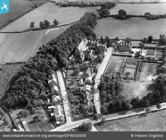
EPW033928 ENGLAND (1930). The Convent of the Holy Name and environs, Great Malvern, 1930
© Copyright OpenStreetMap contributors and licensed by the OpenStreetMap Foundation. 2026. Cartography is licensed as CC BY-SA.
Nearby Images (3)
EPW033928

EPW041836

EPW041835

Details
| Title | [EPW033928] The Convent of the Holy Name and environs, Great Malvern, 1930 |
| Reference | EPW033928 |
| Date | July-1930 |
| Link | |
| Place name | GREAT MALVERN |
| Parish | MALVERN |
| District | |
| Country | ENGLAND |
| Easting / Northing | 379119, 248103 |
| Longitude / Latitude | -2.3050806645585, 52.130427196707 |
| National Grid Reference | SO791481 |
Pins
Be the first to add a comment to this image!