
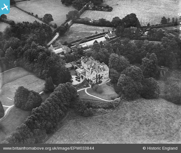
EPW033844 ENGLAND (1930). St Andrew's School (later the Abbey School), Ashurst Wood, 1930
© Copyright OpenStreetMap contributors and licensed by the OpenStreetMap Foundation. 2025. Cartography is licensed as CC BY-SA.
Nearby Images (6)
EPW033844
, Ashurst Wood, 1930")
EPW033843
, Ashurst Wood, 1930")
EPW033842
, Ashurst Wood, 1930")
EPW033845
, Ashurst Wood, 1930")
EPW033846
, Ashurst Wood, 1930")
EPW033841
, Ashurst Wood, 1930")
Details
| Title | [EPW033844] St Andrew's School (later the Abbey School), Ashurst Wood, 1930 |
| Reference | EPW033844 |
| Date | July-1930 |
| Link | |
| Place name | ASHURST WOOD |
| Parish | ASHURST WOOD |
| District | |
| Country | ENGLAND |
| Easting / Northing | 542488, 136604 |
| Longitude / Latitude | 0.035745635145219, 51.110466083511 |
| National Grid Reference | TQ425366 |
Pins

Keith Andrews |
Sunday 23rd of July 2023 10:05:55 AM | |
|
Keith Andrews |
Sunday 23rd of July 2023 09:59:28 AM |