
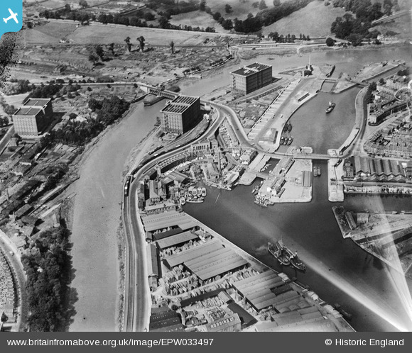
EPW033497 ENGLAND (1930). The Underfall Yard and Cumberland Basin, Bristol, 1930
© Copyright OpenStreetMap contributors and licensed by the OpenStreetMap Foundation. 2026. Cartography is licensed as CC BY-SA.
Nearby Images (10)
EPW033497

EAW033326

EAW002051

EAW033324

EPW012015

EAW002050

EPW012016

EPW032528

EPW012231
, the Floating Harbour and Hotwells, Bristol, 1924. This image has been produced from a copy-negative.")
EPW034461

Details
| Title | [EPW033497] The Underfall Yard and Cumberland Basin, Bristol, 1930 |
| Reference | EPW033497 |
| Date | July-1930 |
| Link | |
| Place name | BRISTOL |
| Parish | |
| District | |
| Country | ENGLAND |
| Easting / Northing | 357133, 172160 |
| Longitude / Latitude | -2.616904154666, 51.446314601101 |
| National Grid Reference | ST571722 |
Pins

Class31 |
Monday 9th of May 2016 09:41:43 PM | |
|
Class31 |
Monday 9th of May 2016 09:34:36 PM | |

SteveRH |
Monday 9th of May 2016 09:28:59 PM | |
|
SteveRH |
Monday 9th of May 2016 09:24:52 PM | |
|
SteveRH |
Monday 9th of May 2016 09:23:59 PM | |
|
kevtees |
Tuesday 4th of March 2014 02:50:58 PM | |
|
Class31 |
Tuesday 6th of August 2013 08:46:09 PM | |
|
Class31 |
Tuesday 6th of August 2013 08:45:32 PM | |
|
Class31 |
Tuesday 6th of August 2013 08:44:19 PM | |
|
pe175 |
Saturday 12th of January 2013 12:28:18 PM | |
|
pe175 |
Saturday 12th of January 2013 12:27:03 PM | |
|
MB |
Wednesday 19th of December 2012 12:33:48 PM | |
|
MB |
Wednesday 19th of December 2012 12:32:26 PM | |
|
kent2 |
Saturday 15th of December 2012 11:59:16 AM |


