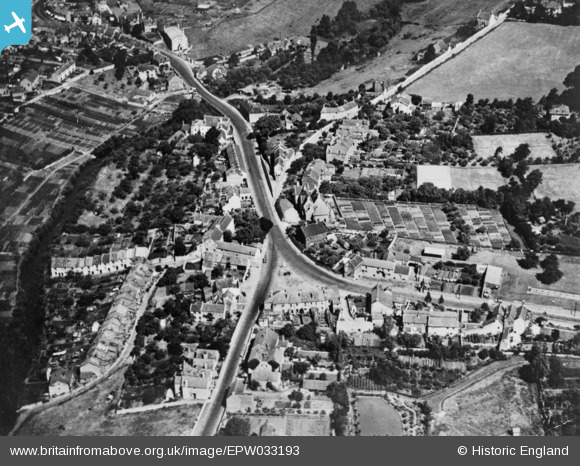
EPW033193 ENGLAND (1930). The junction of Bath Hill East and Bath Road, Keynsham, 1930. This image has been produced from a copy-negative.
© Copyright OpenStreetMap contributors and licensed by the OpenStreetMap Foundation. 2025. Cartography is licensed as CC BY-SA.
Details
| Title | [EPW033193] The junction of Bath Hill East and Bath Road, Keynsham, 1930. This image has been produced from a copy-negative. |
| Reference | EPW033193 |
| Date | July-1930 |
| Link | |
| Place name | KEYNSHAM |
| Parish | KEYNSHAM |
| District | |
| Country | ENGLAND |
| Easting / Northing | 365763, 168299 |
| Longitude / Latitude | -2.4923410477065, 51.412183065559 |
| National Grid Reference | ST658683 |
Pins
 D Rice |
Friday 21st of January 2022 03:09:21 PM |


![[EPW033193] The junction of Bath Hill East and Bath Road, Keynsham, 1930. This image has been produced from a copy-negative.](http://britainfromabove.org.uk/sites/all/libraries/aerofilms-images/public/100x100/EPW/033/EPW033193.jpg)
![[EPW033190] The town, Keynsham, 1930. This image has been produced from a copy-negative.](http://britainfromabove.org.uk/sites/all/libraries/aerofilms-images/public/100x100/EPW/033/EPW033190.jpg)