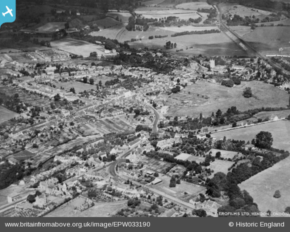
EPW033190 ENGLAND (1930). The town, Keynsham, 1930. This image has been produced from a copy-negative.
© Copyright OpenStreetMap contributors and licensed by the OpenStreetMap Foundation. 2025. Cartography is licensed as CC BY-SA.
Details
| Title | [EPW033190] The town, Keynsham, 1930. This image has been produced from a copy-negative. |
| Reference | EPW033190 |
| Date | July-1930 |
| Link | |
| Place name | KEYNSHAM |
| Parish | KEYNSHAM |
| District | |
| Country | ENGLAND |
| Easting / Northing | 365542, 168487 |
| Longitude / Latitude | -2.4955372607777, 51.413860227174 |
| National Grid Reference | ST655685 |
Pins
User Comment Contributions
St. John the Baptist's Church, Keynsham, 06/06/2015 |
 Class31 |
Tuesday 9th of June 2015 02:19:12 PM |


![[EPW033190] The town, Keynsham, 1930. This image has been produced from a copy-negative.](http://britainfromabove.org.uk/sites/all/libraries/aerofilms-images/public/100x100/EPW/033/EPW033190.jpg)
![[EPW033193] The junction of Bath Hill East and Bath Road, Keynsham, 1930. This image has been produced from a copy-negative.](http://britainfromabove.org.uk/sites/all/libraries/aerofilms-images/public/100x100/EPW/033/EPW033193.jpg)
