
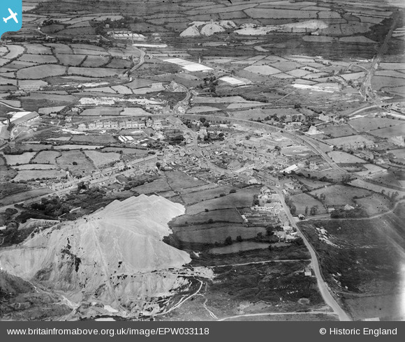
EPW033118 ENGLAND (1930). The village and environs, Bugle, 1930
© Copyright OpenStreetMap contributors and licensed by the OpenStreetMap Foundation. 2025. Cartography is licensed as CC BY-SA.
Nearby Images (5)
EPW033118

EPW033115

EPW033114

EPW033117

EPW033116

Details
| Title | [EPW033118] The village and environs, Bugle, 1930 |
| Reference | EPW033118 |
| Date | July-1930 |
| Link | |
| Place name | BUGLE |
| Parish | TREVERBYN |
| District | |
| Country | ENGLAND |
| Easting / Northing | 201573, 58837 |
| Longitude / Latitude | -4.7921615695557, 50.39526519178 |
| National Grid Reference | SX016588 |
Pins
Be the first to add a comment to this image!