
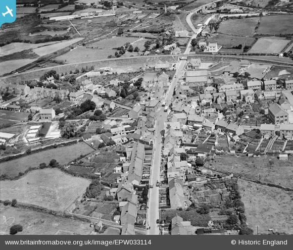
EPW033114 ENGLAND (1930). Fore Street and environs, Bugle, 1930
© Copyright OpenStreetMap contributors and licensed by the OpenStreetMap Foundation. 2025. Cartography is licensed as CC BY-SA.
Nearby Images (5)
EPW033114

EPW033115

EPW033118

EPW033117

EPW033116

Details
| Title | [EPW033114] Fore Street and environs, Bugle, 1930 |
| Reference | EPW033114 |
| Date | July-1930 |
| Link | |
| Place name | BUGLE |
| Parish | TREVERBYN |
| District | |
| Country | ENGLAND |
| Easting / Northing | 201531, 58860 |
| Longitude / Latitude | -4.7927639741087, 50.395457633363 |
| National Grid Reference | SX015589 |
Pins

MB |
Tuesday 6th of September 2016 09:52:00 PM | |
|
MB |
Tuesday 6th of September 2016 09:49:38 PM | |
|
MB |
Tuesday 6th of September 2016 09:47:55 PM | |
|
MB |
Tuesday 6th of September 2016 09:47:29 PM |