
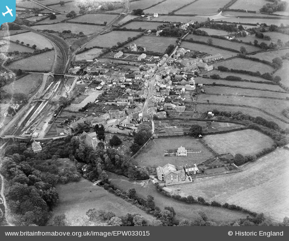
EPW033015 ENGLAND (1930). The railway station and village, South Brent, 1930
© Copyright OpenStreetMap contributors and licensed by the OpenStreetMap Foundation. 2026. Cartography is licensed as CC BY-SA.
Nearby Images (3)
EPW033015

EPW033014

EPW033016

Details
| Title | [EPW033015] The railway station and village, South Brent, 1930 |
| Reference | EPW033015 |
| Date | July-1930 |
| Link | |
| Place name | SOUTH BRENT |
| Parish | SOUTH BRENT |
| District | |
| Country | ENGLAND |
| Easting / Northing | 269680, 60173 |
| Longitude / Latitude | -3.8349179610629, 50.426328466967 |
| National Grid Reference | SX697602 |
Pins

Brightonboy |
Thursday 18th of February 2016 07:42:23 AM | |
|
Brightonboy |
Thursday 18th of February 2016 07:41:36 AM |