
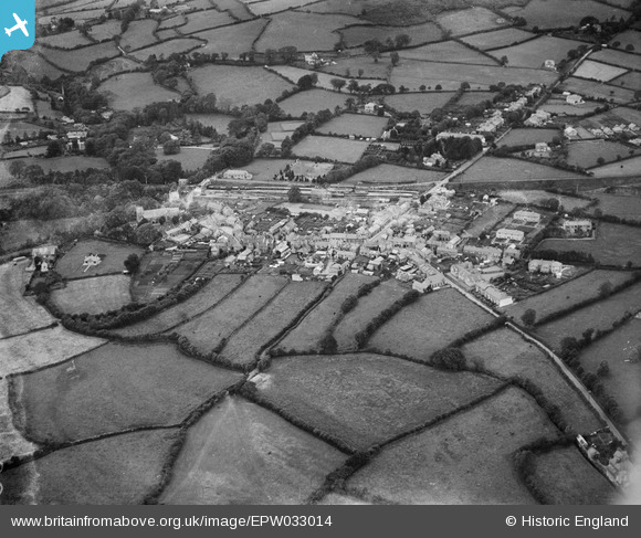
EPW033014 ENGLAND (1930). The railway station, village and surrounding countryside, South Brent, 1930
© Copyright OpenStreetMap contributors and licensed by the OpenStreetMap Foundation. 2026. Cartography is licensed as CC BY-SA.
Nearby Images (3)
EPW033014

EPW033016

EPW033015

Details
| Title | [EPW033014] The railway station, village and surrounding countryside, South Brent, 1930 |
| Reference | EPW033014 |
| Date | July-1930 |
| Link | |
| Place name | SOUTH BRENT |
| Parish | SOUTH BRENT |
| District | |
| Country | ENGLAND |
| Easting / Northing | 269750, 60112 |
| Longitude / Latitude | -3.8339117055782, 50.425795639167 |
| National Grid Reference | SX698601 |
Pins
Be the first to add a comment to this image!