
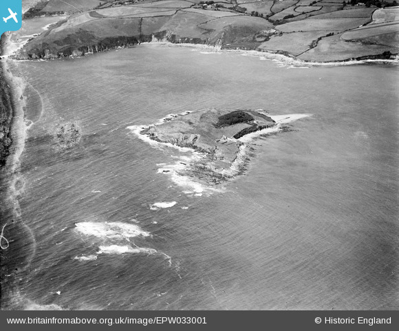
EPW033001 ENGLAND (1930). St George's or Looe Island and the Inner and Outer Ranneys, Looe, 1930
© Copyright OpenStreetMap contributors and licensed by the OpenStreetMap Foundation. 2026. Cartography is licensed as CC BY-SA.
Nearby Images (3)
EPW033001

EPW033000

EPW032999

Details
| Title | [EPW033001] St George's or Looe Island and the Inner and Outer Ranneys, Looe, 1930 |
| Reference | EPW033001 |
| Date | July-1930 |
| Link | |
| Place name | LOOE |
| Parish | LOOE |
| District | |
| Country | ENGLAND |
| Easting / Northing | 225937, 51341 |
| Longitude / Latitude | -4.4462127776081, 50.335626771663 |
| National Grid Reference | SX259513 |
Pins
Be the first to add a comment to this image!