
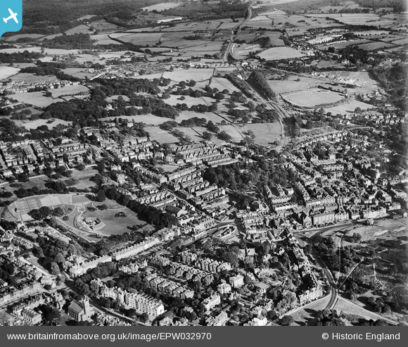
EPW032970 ENGLAND (1930). The Grove and environs, Royal Tunbridge Wells, 1930
© Copyright OpenStreetMap contributors and licensed by the OpenStreetMap Foundation. 2026. Cartography is licensed as CC BY-SA.
Nearby Images (12)
EPW032970

EPW032969

EPW032967

EPW032965

EPW032962

EPW032961

EPW032968

EPW032963

EPW032959

EPW032964

EPW032960

EAW053167

Details
| Title | [EPW032970] The Grove and environs, Royal Tunbridge Wells, 1930 |
| Reference | EPW032970 |
| Date | June-1930 |
| Link | |
| Place name | ROYAL TUNBRIDGE WELLS |
| Parish | |
| District | |
| Country | ENGLAND |
| Easting / Northing | 558652, 138959 |
| Longitude / Latitude | 0.26753536200619, 51.127381387251 |
| National Grid Reference | TQ587390 |
Pins

Garry |
Sunday 24th of February 2013 02:52:54 PM |
User Comment Contributions
Pic of the WW1 Tank outside the old Post Office. |
Garry |
Sunday 24th of February 2013 03:03:55 PM |