
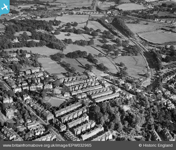
EPW032965 ENGLAND (1930). Nevill Cricket and Athletic Ground, Claremont Road and environs, Royal Tunbridge Wells, 1930
© Copyright OpenStreetMap contributors and licensed by the OpenStreetMap Foundation. 2026. Cartography is licensed as CC BY-SA.
Nearby Images (23)
EPW032965

EPW032962

EPW032964

EPW032959

EPW032960

EPW032967

EPW032968

EPW032961

EPW032963

EAW053167

EPW032966

EAW053175

EAW053176

EAW053173

EAW053171

EAW053168

EAW053174

EAW053172

EPW032969

EPW032970

EAW053169

EPW032971

EAW053170

Details
| Title | [EPW032965] Nevill Cricket and Athletic Ground, Claremont Road and environs, Royal Tunbridge Wells, 1930 |
| Reference | EPW032965 |
| Date | June-1930 |
| Link | |
| Place name | ROYAL TUNBRIDGE WELLS |
| Parish | |
| District | |
| Country | ENGLAND |
| Easting / Northing | 558803, 138810 |
| Longitude / Latitude | 0.26962606287975, 51.126000620658 |
| National Grid Reference | TQ588388 |
Pins
Be the first to add a comment to this image!