
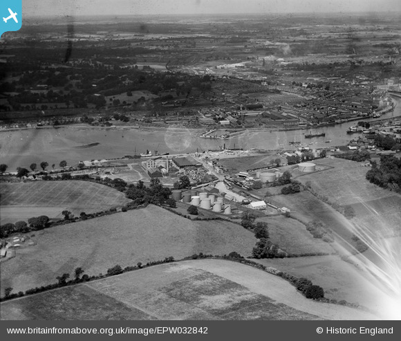
EPW032842 ENGLAND (1930). The Orwell Brick Works and environs, Ipswich, from the south-east, 1930
© Copyright OpenStreetMap contributors and licensed by the OpenStreetMap Foundation. 2026. Cartography is licensed as CC BY-SA.
Nearby Images (8)
EPW032842

EPW032852

EPW032862

EPW032848

EPW032861

EPW032843

EPW032831

EPW032844

Details
| Title | [EPW032842] The Orwell Brick Works and environs, Ipswich, from the south-east, 1930 |
| Reference | EPW032842 |
| Date | June-1930 |
| Link | |
| Place name | IPSWICH |
| Parish | |
| District | |
| Country | ENGLAND |
| Easting / Northing | 617367, 242589 |
| Longitude / Latitude | 1.1697055517204, 52.038598500154 |
| National Grid Reference | TM174426 |
Pins

dale |
Wednesday 12th of March 2014 10:35:55 AM | |
|
dale |
Wednesday 12th of March 2014 10:32:49 AM | |
|
dale |
Wednesday 12th of March 2014 10:27:04 AM | |
|
dale |
Wednesday 12th of March 2014 10:21:14 AM | |
|
dale |
Wednesday 12th of March 2014 10:19:24 AM | |
|
dale |
Wednesday 12th of March 2014 10:14:19 AM | |
|
dale |
Wednesday 12th of March 2014 10:06:08 AM |