
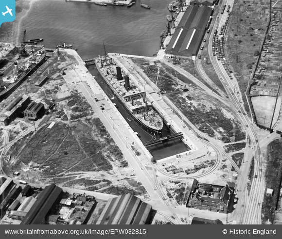
EPW032815 ENGLAND (1930). The Dry Docks, Tilbury, 1930
© Copyright OpenStreetMap contributors and licensed by the OpenStreetMap Foundation. 2026. Cartography is licensed as CC BY-SA.
Nearby Images (12)
EPW032815

EAW053228

EAW053230

EAW053227

EAW053226

EAW053229

EAW053225

EAR036175

EPW032813

EPW032814

EPW044225

EPW044223

Details
| Title | [EPW032815] The Dry Docks, Tilbury, 1930 |
| Reference | EPW032815 |
| Date | 19-June-1930 |
| Link | |
| Place name | TILBURY |
| Parish | |
| District | |
| Country | ENGLAND |
| Easting / Northing | 564080, 175579 |
| Longitude / Latitude | 0.36187631251176, 51.454891418248 |
| National Grid Reference | TQ641756 |
Pins
Be the first to add a comment to this image!