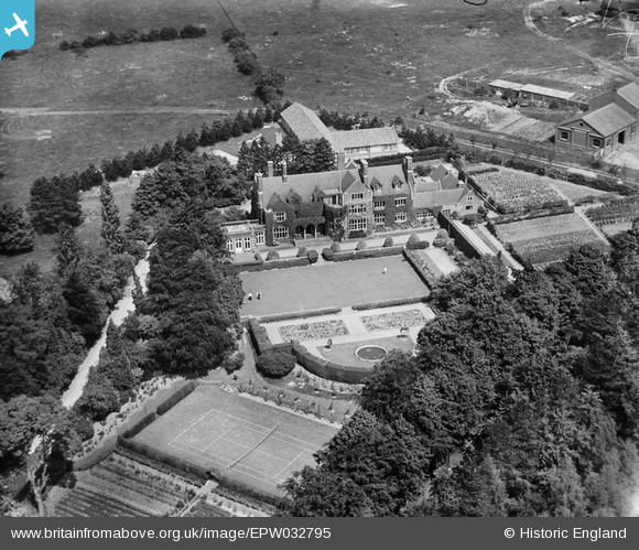
EPW032795 ENGLAND (1930). Ex-Services Welfare Society Milner House, Ashtead, 1930
© Copyright OpenStreetMap contributors and licensed by the OpenStreetMap Foundation. 2026. Cartography is licensed as CC BY-SA.
Nearby Images (9)
Details
| Title | [EPW032795] Ex-Services Welfare Society Milner House, Ashtead, 1930 |
| Reference | EPW032795 |
| Date | June-1930 |
| Link | |
| Place name | ASHTEAD |
| Parish | |
| District | |
| Country | ENGLAND |
| Easting / Northing | 518135, 156786 |
| Longitude / Latitude | -0.30536401516227, 51.297421538877 |
| National Grid Reference | TQ181568 |
Pins
Be the first to add a comment to this image!


![[EPW032795] Ex-Services Welfare Society Milner House, Ashtead, 1930](http://britainfromabove.org.uk/sites/all/libraries/aerofilms-images/public/100x100/EPW/032/EPW032795.jpg)
![[EPW017558] Artificial Silk Works, Ashtead, 1927. This image was marked by Aerofilms Ltd for photo editing.](http://britainfromabove.org.uk/sites/all/libraries/aerofilms-images/public/100x100/EPW/017/EPW017558.jpg)
![[EPW032788] Artificial Silk Works, Ashtead, 1930](http://britainfromabove.org.uk/sites/all/libraries/aerofilms-images/public/100x100/EPW/032/EPW032788.jpg)
![[EPW025239] Industrial complex next to Long House, Ashtead, 1928. This image has been produced from a copy-negative.](http://britainfromabove.org.uk/sites/all/libraries/aerofilms-images/public/100x100/EPW/025/EPW025239.jpg)
![[EPW009813A] The Artificial Silk Works beside Frederick Milner House, Ashstead, 1924](http://britainfromabove.org.uk/sites/all/libraries/aerofilms-images/public/100x100/EPW/009/EPW009813A.jpg)
![[EPW009813] The Artificial Silk Works beside Frederick Milner House, Ashstead, 1924. This image has been produced from a damaged negative.](http://britainfromabove.org.uk/sites/all/libraries/aerofilms-images/public/100x100/EPW/009/EPW009813.jpg)
![[EPW032793] Artificial Silk Works, Ashtead, 1930](http://britainfromabove.org.uk/sites/all/libraries/aerofilms-images/public/100x100/EPW/032/EPW032793.jpg)
![[EPW032792] Artificial Silk Works, Ashtead, 1930](http://britainfromabove.org.uk/sites/all/libraries/aerofilms-images/public/100x100/EPW/032/EPW032792.jpg)
![[EPW032787] Artificial Silk Works, Ashtead, 1930](http://britainfromabove.org.uk/sites/all/libraries/aerofilms-images/public/100x100/EPW/032/EPW032787.jpg)