
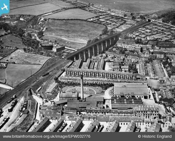
EPW032776 ENGLAND (1930). Horner's Dainty Dinah Toffee Factory and Chester Burn Viaduct, Chester-Le-Street, 1930. This image has been produced from a copy-negative.
© Copyright OpenStreetMap contributors and licensed by the OpenStreetMap Foundation. 2026. Cartography is licensed as CC BY-SA.
Nearby Images (15)
EPW032776

EPW031529

EPW031522

EPW031528

EPW031525

EPW014379

EPW032775

EPW031523

EPW014381

EPW031527

EPW031526

EPW031524

EPW016429

EPW014385

EPW031530

Details
| Title | [EPW032776] Horner's Dainty Dinah Toffee Factory and Chester Burn Viaduct, Chester-Le-Street, 1930. This image has been produced from a copy-negative. |
| Reference | EPW032776 |
| Date | June-1930 |
| Link | |
| Place name | CHESTER-LE-STREET |
| Parish | |
| District | |
| Country | ENGLAND |
| Easting / Northing | 427183, 551462 |
| Longitude / Latitude | -1.5765178059181, 54.857121659273 |
| National Grid Reference | NZ272515 |
Pins
Be the first to add a comment to this image!