
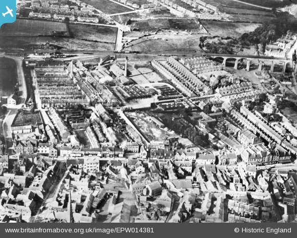
EPW014381 ENGLAND (1925). The Stag Confectionery Works and environs, Chester-Le-Street, 1925. This image has been produced from a copy-negative.
© Copyright OpenStreetMap contributors and licensed by the OpenStreetMap Foundation. 2026. Cartography is licensed as CC BY-SA.
Nearby Images (15)
EPW014381

EPW031526

EPW031523

EPW031525

EPW016429

EPW031528

EPW031522

EPW031524

EPW031527

EPW031529

EPW031530

EPW014379

EPW032775

EPW032776

EPW014385

Details
| Title | [EPW014381] The Stag Confectionery Works and environs, Chester-Le-Street, 1925. This image has been produced from a copy-negative. |
| Reference | EPW014381 |
| Date | September-1925 |
| Link | |
| Place name | CHESTER-LE-STREET |
| Parish | |
| District | |
| Country | ENGLAND |
| Easting / Northing | 427322, 551399 |
| Longitude / Latitude | -1.5743583623366, 54.85654789714 |
| National Grid Reference | NZ273514 |
Pins
Be the first to add a comment to this image!