
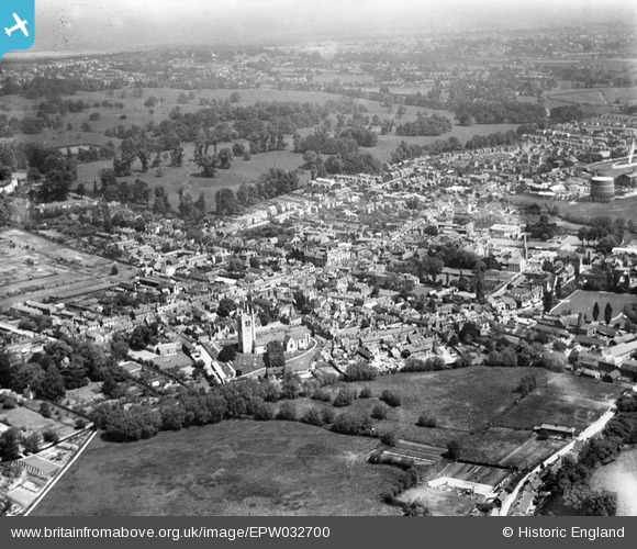
EPW032700 ENGLAND (1930). The town, Farnham, from the south-west, 1930
© Copyright OpenStreetMap contributors and licensed by the OpenStreetMap Foundation. 2026. Cartography is licensed as CC BY-SA.
Nearby Images (4)
EPW032700

EPW032698

EPW032697

EPW056808

Details
| Title | [EPW032700] The town, Farnham, from the south-west, 1930 |
| Reference | EPW032700 |
| Date | June-1930 |
| Link | |
| Place name | FARNHAM |
| Parish | FARNHAM |
| District | |
| Country | ENGLAND |
| Easting / Northing | 483870, 146621 |
| Longitude / Latitude | -0.79913605074177, 51.212109964525 |
| National Grid Reference | SU839466 |
Pins

John Wainwright |
Friday 28th of December 2012 03:57:22 PM | |
|
John Wainwright |
Friday 28th of December 2012 03:55:03 PM | |
|
John Wainwright |
Friday 28th of December 2012 03:41:07 PM |