
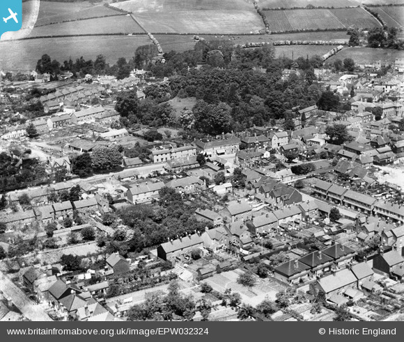
EPW032324 ENGLAND (1930). Housing along Butts Road and the Public Gardens, Alton, 1930
© Copyright OpenStreetMap contributors and licensed by the OpenStreetMap Foundation. 2026. Cartography is licensed as CC BY-SA.
Nearby Images (5)
EPW032324

EPW023428

EPW001512

EPW023427

EPW023429

Details
| Title | [EPW032324] Housing along Butts Road and the Public Gardens, Alton, 1930 |
| Reference | EPW032324 |
| Date | June-1930 |
| Link | |
| Place name | ALTON |
| Parish | ALTON |
| District | |
| Country | ENGLAND |
| Easting / Northing | 471528, 139044 |
| Longitude / Latitude | -0.97732651924051, 51.145660664717 |
| National Grid Reference | SU715390 |
Pins

mikeybikey |
Thursday 9th of April 2015 06:47:23 PM | |
|
David960 |
Thursday 12th of February 2015 06:36:08 PM |