
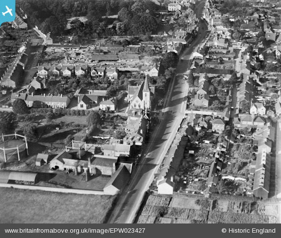
EPW023427 ENGLAND (1928). Butts Road and All Saints' Church, Alton, 1928
© Copyright OpenStreetMap contributors and licensed by the OpenStreetMap Foundation. 2026. Cartography is licensed as CC BY-SA.
Nearby Images (4)
EPW023427

EPW001512

EPW023428

EPW032324

Details
| Title | [EPW023427] Butts Road and All Saints' Church, Alton, 1928 |
| Reference | EPW023427 |
| Date | September-1928 |
| Link | |
| Place name | ALTON |
| Parish | ALTON |
| District | |
| Country | ENGLAND |
| Easting / Northing | 471402, 138932 |
| Longitude / Latitude | -0.97914991770358, 51.14466933833 |
| National Grid Reference | SU714389 |
Pins

mikeybikey |
Thursday 9th of April 2015 06:33:21 PM | |
|
Sweet Pete |
Saturday 28th of March 2015 05:25:52 PM | |
|
Sweet Pete |
Saturday 28th of March 2015 05:25:01 PM |