
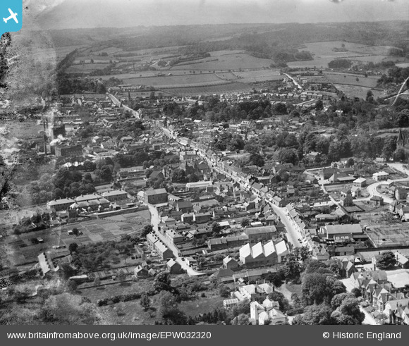
EPW032320 ENGLAND (1930). The town, Alton, from the north-east, 1930
© Copyright OpenStreetMap contributors and licensed by the OpenStreetMap Foundation. 2025. Cartography is licensed as CC BY-SA.
Nearby Images (3)
EPW032320

EPW023431

EPW032321

Details
| Title | [EPW032320] The town, Alton, from the north-east, 1930 |
| Reference | EPW032320 |
| Date | June-1930 |
| Link | |
| Place name | ALTON |
| Parish | ALTON |
| District | |
| Country | ENGLAND |
| Easting / Northing | 472020, 139549 |
| Longitude / Latitude | -0.97019229274232, 51.150139711169 |
| National Grid Reference | SU720395 |
Pins

David960 |
Monday 2nd of February 2015 12:34:27 AM | |
|
David960 |
Monday 2nd of February 2015 12:33:01 AM | |
|
David960 |
Monday 2nd of February 2015 12:31:46 AM | |
|
David960 |
Monday 2nd of February 2015 12:31:16 AM | |
|
pd brambles |
Tuesday 12th of November 2013 09:36:32 PM | |
No, it was not a bus garage, that was in Amery Street. |
flubber |
Friday 10th of January 2014 07:50:49 PM |
|
pd brambles |
Tuesday 12th of November 2013 09:35:44 PM |