
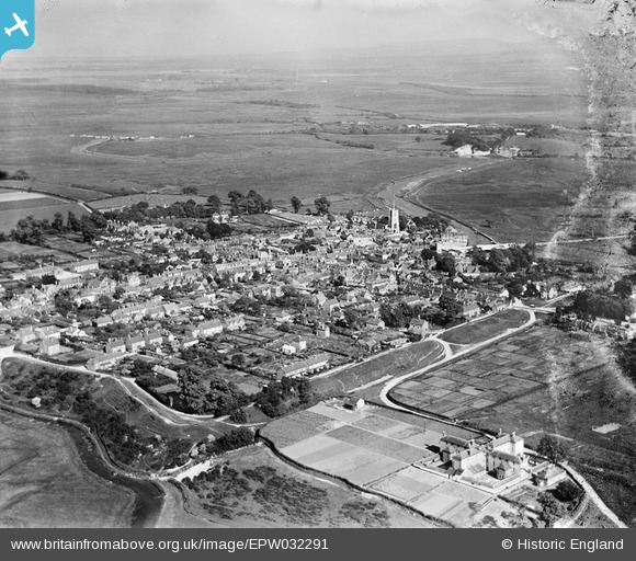
EPW032291 ENGLAND (1930). The Poor Law Institution, the town and surrounding countryside, Wareham, from the north-west, 1930
© Copyright OpenStreetMap contributors and licensed by the OpenStreetMap Foundation. 2026. Cartography is licensed as CC BY-SA.
Nearby Images (2)
EPW032291

EPW032292

Details
| Title | [EPW032291] The Poor Law Institution, the town and surrounding countryside, Wareham, from the north-west, 1930 |
| Reference | EPW032291 |
| Date | June-1930 |
| Link | |
| Place name | WAREHAM |
| Parish | WAREHAM TOWN |
| District | |
| Country | ENGLAND |
| Easting / Northing | 391974, 87482 |
| Longitude / Latitude | -2.1136266538867, 50.68635821305 |
| National Grid Reference | SY920875 |
Pins

Dylan Moore |
Saturday 9th of March 2013 08:09:41 PM | |
|
Dylan Moore |
Saturday 9th of March 2013 08:08:34 PM | |

micky |
Wednesday 27th of February 2013 11:12:20 AM | |
|
micky |
Wednesday 27th of February 2013 11:11:27 AM | |
|
micky |
Monday 7th of January 2013 04:14:52 PM | |
|
micky |
Monday 7th of January 2013 04:13:01 PM | |
|
micky |
Wednesday 2nd of January 2013 07:53:20 AM | |
|
micky |
Wednesday 2nd of January 2013 07:52:58 AM | |
|
micky |
Wednesday 2nd of January 2013 07:52:21 AM | |
|
micky |
Wednesday 2nd of January 2013 07:51:49 AM | |
|
micky |
Wednesday 2nd of January 2013 07:51:09 AM | |
|
micky |
Wednesday 2nd of January 2013 07:50:48 AM | |
|
micky |
Wednesday 2nd of January 2013 07:49:49 AM | |
|
micky |
Wednesday 2nd of January 2013 07:49:09 AM | |

Class31 |
Monday 5th of November 2012 02:50:34 PM | |
|
Class31 |
Monday 5th of November 2012 02:49:47 PM |