
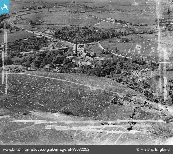
EPW032252 ENGLAND (1930). The Bardsley Vale Mills and Lime Hurst Farm, Limehurst, 1930. This image has been produced from a damaged negative.
© Copyright OpenStreetMap contributors and licensed by the OpenStreetMap Foundation. 2026. Cartography is licensed as CC BY-SA.
Nearby Images (7)
EPW032252

EPW032257

EPW032247

EPW032249

EPW032256

EPW032255

EPW032258

Details
| Title | [EPW032252] The Bardsley Vale Mills and Lime Hurst Farm, Limehurst, 1930. This image has been produced from a damaged negative. |
| Reference | EPW032252 |
| Date | June-1930 |
| Link | |
| Place name | LIMEHURST |
| Parish | |
| District | |
| Country | ENGLAND |
| Easting / Northing | 393273, 401261 |
| Longitude / Latitude | -2.1014415985718, 53.507744643881 |
| National Grid Reference | SD933013 |
Pins
Be the first to add a comment to this image!