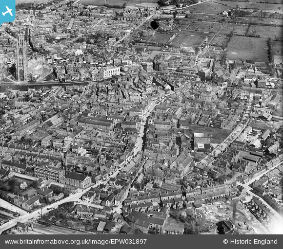
EPW031897 ENGLAND (1930). West Street and environs, Boston, 1930
© Copyright OpenStreetMap contributors and licensed by the OpenStreetMap Foundation. 2026. Cartography is licensed as CC BY-SA.
Nearby Images (10)
Details
| Title | [EPW031897] West Street and environs, Boston, 1930 |
| Reference | EPW031897 |
| Date | May-1930 |
| Link | |
| Place name | BOSTON |
| Parish | |
| District | |
| Country | ENGLAND |
| Easting / Northing | 532536, 343931 |
| Longitude / Latitude | -0.025900836183076, 52.976009129197 |
| National Grid Reference | TF325439 |
Pins

Jim Dugdale |
Friday 12th of July 2019 08:04:32 PM | |

Jim Dugdale |
Friday 12th of July 2019 08:00:58 PM | |

claxby |
Wednesday 17th of December 2014 08:51:05 PM | |

Scooby |
Sunday 20th of July 2014 12:07:13 PM | |

Triggy |
Friday 24th of January 2014 08:37:51 PM |
User Comment Contributions
Bit more detail in this pic. |

godeye |
Wednesday 2nd of December 2015 06:13:06 PM |


![[EPW031897] West Street and environs, Boston, 1930](http://britainfromabove.org.uk/sites/all/libraries/aerofilms-images/public/100x100/EPW/031/EPW031897.jpg)
![[EPW031899] The Haven and the town, Boston, 1930](http://britainfromabove.org.uk/sites/all/libraries/aerofilms-images/public/100x100/EPW/031/EPW031899.jpg)
![[EPW031890] The Haven and the town, Boston, 1930](http://britainfromabove.org.uk/sites/all/libraries/aerofilms-images/public/100x100/EPW/031/EPW031890.jpg)
![[EPW031901] St Botolph's Church, The Haven and the town, Boston, 1930](http://britainfromabove.org.uk/sites/all/libraries/aerofilms-images/public/100x100/EPW/031/EPW031901.jpg)
![[EAW035448] St Botolph's Church and environs, Boston, 1951. This image has been produced from a print.](http://britainfromabove.org.uk/sites/all/libraries/aerofilms-images/public/100x100/EAW/035/EAW035448.jpg)
![[EPW031902] St Botolph's Church, The Haven and the town, Boston, 1930](http://britainfromabove.org.uk/sites/all/libraries/aerofilms-images/public/100x100/EPW/031/EPW031902.jpg)
![[EAW035451] St Botolph's Church and environs, Boston, 1951. This image has been produced from a print.](http://britainfromabove.org.uk/sites/all/libraries/aerofilms-images/public/100x100/EAW/035/EAW035451.jpg)
![[EPW031900] St Botolph's Church and environs, Boston, 1930](http://britainfromabove.org.uk/sites/all/libraries/aerofilms-images/public/100x100/EPW/031/EPW031900.jpg)
![[EAW035449] St Botolph's Church and the Market Place, Boston, 1951. This image has been produced from a print.](http://britainfromabove.org.uk/sites/all/libraries/aerofilms-images/public/100x100/EAW/035/EAW035449.jpg)
![[EPW031892] The Haven, the town and St Botolph's Church, Boston, 1930](http://britainfromabove.org.uk/sites/all/libraries/aerofilms-images/public/100x100/EPW/031/EPW031892.jpg)