
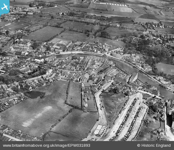
EPW031893 ENGLAND (1930). St Aidan's Church, The Haven and environs, Boston, 1930
© Copyright OpenStreetMap contributors and licensed by the OpenStreetMap Foundation. 2026. Cartography is licensed as CC BY-SA.
Nearby Images (3)
EPW031893

EPW031892

EPW031890

Details
| Title | [EPW031893] St Aidan's Church, The Haven and environs, Boston, 1930 |
| Reference | EPW031893 |
| Date | May-1930 |
| Link | |
| Place name | BOSTON |
| Parish | |
| District | |
| Country | ENGLAND |
| Easting / Northing | 532753, 343551 |
| Longitude / Latitude | -0.022826656730331, 52.972541169483 |
| National Grid Reference | TF328436 |
Pins
Be the first to add a comment to this image!