
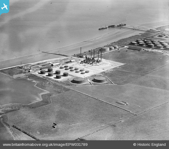
EPW031789 ENGLAND (1930). Oil terminal, North Killingholme Haven, 1930
© Copyright OpenStreetMap contributors and licensed by the OpenStreetMap Foundation. 2026. Cartography is licensed as CC BY-SA.
Nearby Images (21)
EPW031789

EPW031620

EPW031786

EPW031787

EPW031791

EPW031788

EPW031792

EPW031612

EPW031790

EPW031610

EPW031613

EPW031614

EPW031616

EPW031611

EPW031615

EPW031794

EPW031793

EPW031617

EPW031618

EPW031609

EPW031619

Details
| Title | [EPW031789] Oil terminal, North Killingholme Haven, 1930 |
| Reference | EPW031789 |
| Date | 30-April-1930 |
| Link | |
| Place name | NORTH KILLINGHOLME HAVEN |
| Parish | NORTH KILLINGHOLME |
| District | |
| Country | ENGLAND |
| Easting / Northing | 515914, 420651 |
| Longitude / Latitude | -0.24528595463272, 53.669234934144 |
| National Grid Reference | TA159207 |
Pins
Be the first to add a comment to this image!