
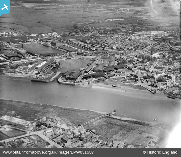
EPW031687 ENGLAND (1930). Alexandra Dock and the Saw Mills, King's Lynn, from the south-west, 1930
© Copyright OpenStreetMap contributors and licensed by the OpenStreetMap Foundation. 2026. Cartography is licensed as CC BY-SA.
Nearby Images (12)
EPW031687

EPW031690

EPW031688

EPW043360

EPW043357

EPW031686

EPW043354

EPW031689

EAW044459

EPW043359

EPW034696

EPW043356

Details
| Title | [EPW031687] Alexandra Dock and the Saw Mills, King's Lynn, from the south-west, 1930 |
| Reference | EPW031687 |
| Date | April-1930 |
| Link | |
| Place name | KING'S LYNN |
| Parish | |
| District | |
| Country | ENGLAND |
| Easting / Northing | 561340, 320372 |
| Longitude / Latitude | 0.39108618765262, 52.756494728747 |
| National Grid Reference | TF613204 |
Pins

locasta |
Sunday 11th of February 2024 09:14:32 PM | |
|
locasta |
Sunday 13th of February 2022 10:09:02 PM | |
|
locasta |
Sunday 13th of February 2022 10:08:02 PM | |
|
toriangel |
Sunday 8th of November 2020 02:22:42 PM | |
|
locasta |
Wednesday 4th of September 2019 03:50:11 PM | |
|
John W |
Sunday 26th of March 2017 10:30:13 PM |
User Comment Contributions
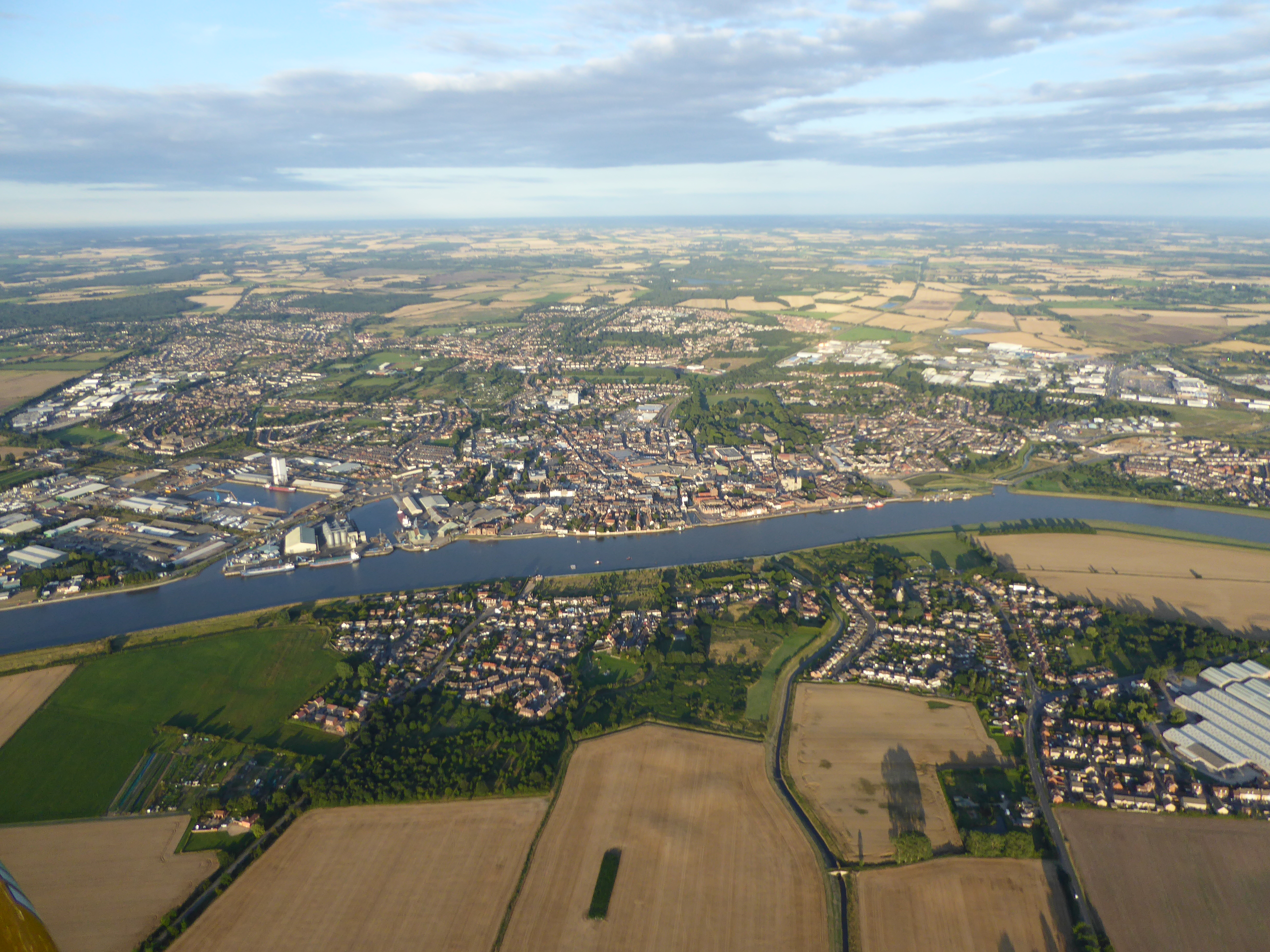
This contemporary point and click view of Kings Lynn from above was taken on the 12 August 2015 from an open cockpit flexwing microlight aircraft at approximately 2000ft. The camera was a Lumix TZ60. The cameras internal GPS gives its Lat/Long position as 52° 45' 1.6"N 0° 21' 40.7"E and the time as 18:27:02(UTC) when the photograph was taken. |
SMFurner |
Friday 14th of August 2015 04:47:56 AM |