
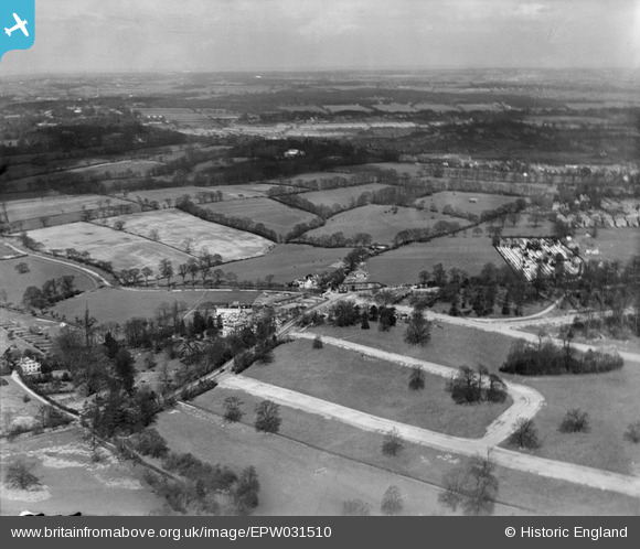
EPW031510 ENGLAND (1930). Abbotshall Avenue, Chandos Avenue and surrounding countryside, New Southgate, from the south, 1930
© Copyright OpenStreetMap contributors and licensed by the OpenStreetMap Foundation. 2026. Cartography is licensed as CC BY-SA.
Nearby Images (2)
EPW031510

EPW035555

Details
| Title | [EPW031510] Abbotshall Avenue, Chandos Avenue and surrounding countryside, New Southgate, from the south, 1930 |
| Reference | EPW031510 |
| Date | February-1930 |
| Link | |
| Place name | NEW SOUTHGATE |
| Parish | |
| District | |
| Country | ENGLAND |
| Easting / Northing | 529265, 193135 |
| Longitude / Latitude | -0.13250157972528, 51.621701334217 |
| National Grid Reference | TQ293931 |
Pins
Be the first to add a comment to this image!