
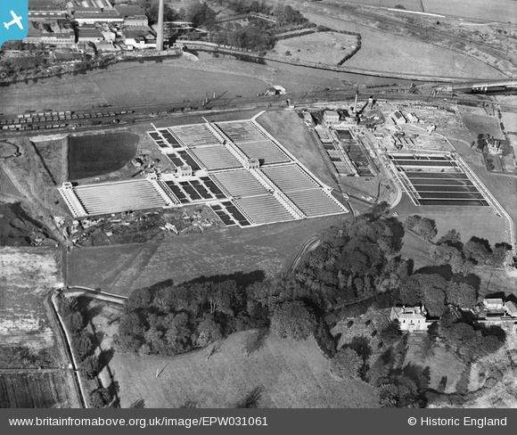
EPW031061 ENGLAND (1929). The Stockport Corporation Sewage Works, Cheadle Heath, 1929
© Copyright OpenStreetMap contributors and licensed by the OpenStreetMap Foundation. 2026. Cartography is licensed as CC BY-SA.
Nearby Images (5)
EPW031061

EPW031062

EPW016470

EPW031060

EPW017462

Details
| Title | [EPW031061] The Stockport Corporation Sewage Works, Cheadle Heath, 1929 |
| Reference | EPW031061 |
| Date | October-1929 |
| Link | |
| Place name | CHEADLE HEATH |
| Parish | |
| District | |
| Country | ENGLAND |
| Easting / Northing | 386819, 389646 |
| Longitude / Latitude | -2.1982789739285, 53.403209698572 |
| National Grid Reference | SJ868896 |
Pins

John Ellis |
Sunday 21st of October 2012 12:51:32 PM | |
|
John Ellis |
Sunday 21st of October 2012 12:50:24 PM | |
|
John Ellis |
Sunday 21st of October 2012 12:49:23 PM | |
|
John Ellis |
Sunday 21st of October 2012 12:48:18 PM | |
|
John Ellis |
Sunday 21st of October 2012 12:47:50 PM | |
|
John Ellis |
Sunday 21st of October 2012 12:47:21 PM | |
|
John Ellis |
Sunday 21st of October 2012 12:46:52 PM | |
|
John Ellis |
Sunday 21st of October 2012 12:46:16 PM | |
|
John Ellis |
Sunday 21st of October 2012 12:45:32 PM |