
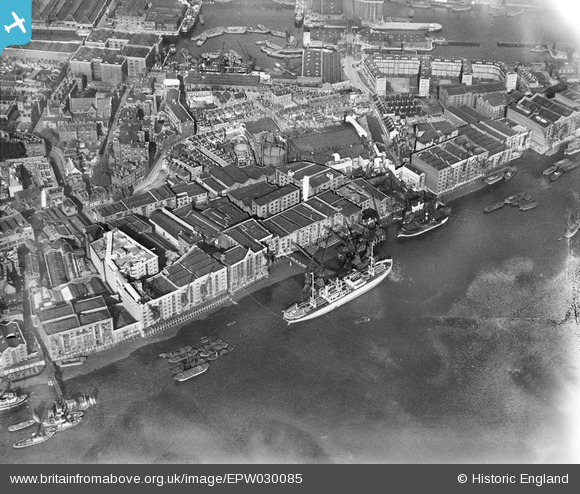
EPW030085 ENGLAND (1929). The Middleton and St Bride's Wharf, Gun Wharves and environs, Wapping, 1929
© Copyright OpenStreetMap contributors and licensed by the OpenStreetMap Foundation. 2026. Cartography is licensed as CC BY-SA.
Nearby Images (22)
EPW030085

EPW030081

EPW030082

EPW030084

EPW030083

EPW007730

EPW030086

EPW030080

EPW030087

EPW007733

EPW007752

EPW007732

EPW007731

EPW007753

EPW032749

EPW032748

EPW007729

EPW032751

EAW022335

EAW016653

EPW032750

EPW007026

Details
| Title | [EPW030085] The Middleton and St Bride's Wharf, Gun Wharves and environs, Wapping, 1929 |
| Reference | EPW030085 |
| Date | October-1929 |
| Link | |
| Place name | WAPPING |
| Parish | |
| District | |
| Country | ENGLAND |
| Easting / Northing | 535063, 180202 |
| Longitude / Latitude | -0.053758765636133, 51.504108025762 |
| National Grid Reference | TQ351802 |
Pins

Dennis Jackson |
Thursday 17th of January 2013 01:34:34 PM | |
|
Dennis Jackson |
Thursday 17th of January 2013 01:33:38 PM |