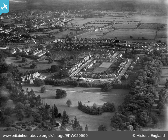
EPW029990 ENGLAND (1929). Whitchurch Gardens and environs, Edgware, from the north-west, 1929
© Copyright OpenStreetMap contributors and licensed by the OpenStreetMap Foundation. 2026. Cartography is licensed as CC BY-SA.
Details
| Title | [EPW029990] Whitchurch Gardens and environs, Edgware, from the north-west, 1929 |
| Reference | EPW029990 |
| Date | September-1929 |
| Link | |
| Place name | EDGWARE |
| Parish | |
| District | |
| Country | ENGLAND |
| Easting / Northing | 518452, 191761 |
| Longitude / Latitude | -0.28910368304996, 51.611731648283 |
| National Grid Reference | TQ185918 |


![[EPW029990] Whitchurch Gardens and environs, Edgware, from the north-west, 1929](http://britainfromabove.org.uk/sites/all/libraries/aerofilms-images/public/100x100/EPW/029/EPW029990.jpg)
![[EPW049510] Canons Park and the surrounding residential area, Stanmore, 1935. This image has been produced from a damaged copy-negative.](http://britainfromabove.org.uk/sites/all/libraries/aerofilms-images/public/100x100/EPW/049/EPW049510.jpg)
![[EPW053049] Canons Park and environs, Canons Park, from the south-west, 1937](http://britainfromabove.org.uk/sites/all/libraries/aerofilms-images/public/100x100/EPW/053/EPW053049.jpg)

