
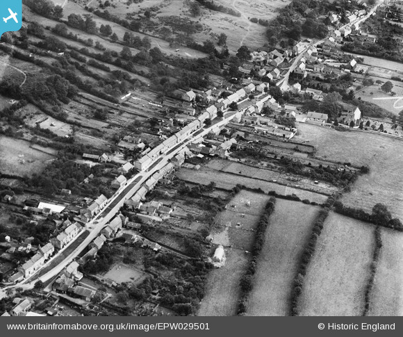
EPW029501 ENGLAND (1929). The village, Ampleforth, 1929
© Copyright OpenStreetMap contributors and licensed by the OpenStreetMap Foundation. 2026. Cartography is licensed as CC BY-SA.
Nearby Images (2)
EPW029501

EPW029505

Details
| Title | [EPW029501] The village, Ampleforth, 1929 |
| Reference | EPW029501 |
| Date | 24-September-1929 |
| Link | |
| Place name | AMPLEFORTH |
| Parish | AMPLEFORTH |
| District | |
| Country | ENGLAND |
| Easting / Northing | 458143, 478696 |
| Longitude / Latitude | -1.108604671469, 54.200547811603 |
| National Grid Reference | SE581787 |
Pins

TonyCoombe |
Saturday 11th of April 2020 08:49:03 PM |