
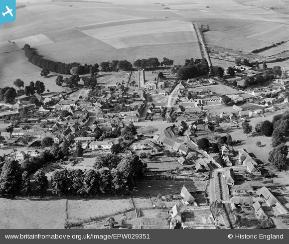
EPW029351 ENGLAND (1929). The Green, St Michael's Church and the village, Aldbourne, 1929
© Copyright OpenStreetMap contributors and licensed by the OpenStreetMap Foundation. 2026. Cartography is licensed as CC BY-SA.
Nearby Images (6)
EPW029351

EPW029354

EPW029353

EPW029352

EPW029350

EPW029355

Details
| Title | [EPW029351] The Green, St Michael's Church and the village, Aldbourne, 1929 |
| Reference | EPW029351 |
| Date | September-1929 |
| Link | |
| Place name | ALDBOURNE |
| Parish | ALDBOURNE |
| District | |
| Country | ENGLAND |
| Easting / Northing | 426455, 175684 |
| Longitude / Latitude | -1.6190117850014, 51.479008498119 |
| National Grid Reference | SU265757 |
Pins

MB |
Saturday 4th of May 2013 11:44:56 AM |
User Comment Contributions
'Albourne, which lies between the Lambourn Downs to the east and the Marlborough Downs to the west, is the truest downland village of them all .. [it] rests between some of the grandest hill-country in Wiltshire ..' Massingham, op cit. |
MB |
Saturday 4th of May 2013 11:56:10 AM |
'Aldbourne, cushioned in by elm and beech .. umber roofed from afar, white among its airy, many-cornered streets .. its building materials are of flint and "clunch" or chalk blocks cut from the harder seams of sarsen stones and of thatch ..' H. J. Massingham, English Downland, B. T. Batsford, 1936, 21 Massingham adds '.. The cottage roofing is mainly thatch or red tiles whose warm tones perfectly with the earth-browns of the thatch, together with the mass-produced blue slating, which many feel to be much too abundant in the chalk lands ..' |
MB |
Saturday 4th of May 2013 11:52:09 AM |