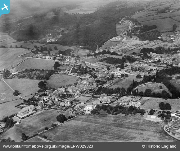
EPW029323 ENGLAND (1929). The town and Millrough Wood, Lydney, from the south, 1929
© Copyright OpenStreetMap contributors and licensed by the OpenStreetMap Foundation. 2024. Cartography is licensed as CC BY-SA.
Nearby Images (5)
Details
| Title | [EPW029323] The town and Millrough Wood, Lydney, from the south, 1929 |
| Reference | EPW029323 |
| Date | September-1929 |
| Link | |
| Place name | LYDNEY |
| Parish | LYDNEY |
| District | |
| Country | ENGLAND |
| Easting / Northing | 363101, 202851 |
| Longitude / Latitude | -2.5342490688398, 51.722708131821 |
| National Grid Reference | SO631029 |
Pins
 gBr |
Thursday 23rd of March 2017 07:58:42 PM |


![[EPW029323] The town and Millrough Wood, Lydney, from the south, 1929](http://britainfromabove.org.uk/sites/all/libraries/aerofilms-images/public/100x100/EPW/029/EPW029323.jpg)
![[EPW029331] The High Street and town, Lydney, 1929](http://britainfromabove.org.uk/sites/all/libraries/aerofilms-images/public/100x100/EPW/029/EPW029331.jpg)
![[EPW029326] The High Street, Newerne Street and environs, Lydney, 1929](http://britainfromabove.org.uk/sites/all/libraries/aerofilms-images/public/100x100/EPW/029/EPW029326.jpg)
![[EPW029329] The town centre, Lydney, 1929](http://britainfromabove.org.uk/sites/all/libraries/aerofilms-images/public/100x100/EPW/029/EPW029329.jpg)
![[EPW029330] The town centre and railway station, Lydney, 1929](http://britainfromabove.org.uk/sites/all/libraries/aerofilms-images/public/100x100/EPW/029/EPW029330.jpg)