
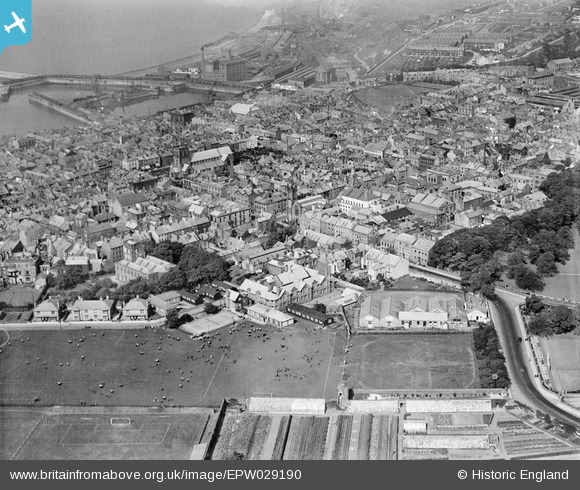
EPW029190 ENGLAND (1929). The town, Whitehaven, from the south-east, 1929
© Copyright OpenStreetMap contributors and licensed by the OpenStreetMap Foundation. 2026. Cartography is licensed as CC BY-SA.
Nearby Images (3)
EPW029190

EPW029185

EPW029191

Details
| Title | [EPW029190] The town, Whitehaven, from the south-east, 1929 |
| Reference | EPW029190 |
| Date | September-1929 |
| Link | |
| Place name | WHITEHAVEN |
| Parish | |
| District | |
| Country | ENGLAND |
| Easting / Northing | 297534, 517854 |
| Longitude / Latitude | -3.5841809306566, 54.545430736496 |
| National Grid Reference | NX975179 |
Pins
 |

Billy Turner |
Wednesday 16th of December 2015 08:37:07 PM |
|
Billy Turner |
Wednesday 16th of December 2015 08:32:46 PM | |
 |
Billy Turner |
Wednesday 16th of December 2015 08:21:33 PM |
 |
Billy Turner |
Wednesday 16th of December 2015 08:10:19 PM |

lesgilpin |
Monday 16th of November 2015 09:42:10 PM |
User Comment Contributions

3 |
MotoFreako64 |
Thursday 25th of October 2012 11:31:04 PM |