
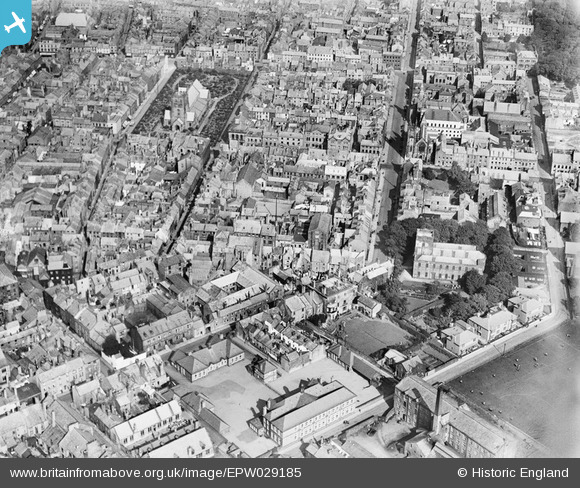
EPW029185 ENGLAND (1929). The town centre, Whitehaven, 1929
© Copyright OpenStreetMap contributors and licensed by the OpenStreetMap Foundation. 2026. Cartography is licensed as CC BY-SA.
Nearby Images (7)
EPW029185

EPW042099

EPW029190

EPW029186

EPW029191

EPW042097

EPW029192

Details
| Title | [EPW029185] The town centre, Whitehaven, 1929 |
| Reference | EPW029185 |
| Date | September-1929 |
| Link | |
| Place name | WHITEHAVEN |
| Parish | |
| District | |
| Country | ENGLAND |
| Easting / Northing | 297389, 517974 |
| Longitude / Latitude | -3.586463596315, 54.546479500881 |
| National Grid Reference | NX974180 |
Pins
Be the first to add a comment to this image!
User Comment Contributions
8 |

MotoFreako64 |
Thursday 25th of October 2012 11:33:15 PM |