
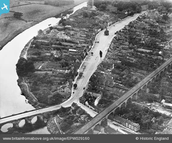
EPW029160 ENGLAND (1929). Yarm Bridge and Viaduct and the High Street, Yarm, 1929. This image has been produced from a copy-negative.
© Copyright OpenStreetMap contributors and licensed by the OpenStreetMap Foundation. 2026. Cartography is licensed as CC BY-SA.
Nearby Images (2)
EPW029160

EPW029159

Details
| Title | [EPW029160] Yarm Bridge and Viaduct and the High Street, Yarm, 1929. This image has been produced from a copy-negative. |
| Reference | EPW029160 |
| Date | September-1929 |
| Link | |
| Place name | YARM |
| Parish | YARM |
| District | |
| Country | ENGLAND |
| Easting / Northing | 441825, 513039 |
| Longitude / Latitude | -1.3539318615688, 54.510800325464 |
| National Grid Reference | NZ418130 |
Pins

John Wass |
Wednesday 20th of May 2015 03:25:21 PM |