
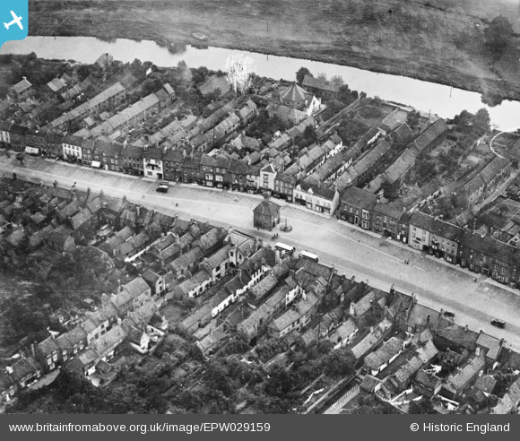
EPW029159 ENGLAND (1929). The High Street, Yarm, 1929. This image has been produced from a damaged copy-negative.
© Copyright OpenStreetMap contributors and licensed by the OpenStreetMap Foundation. 2026. Cartography is licensed as CC BY-SA.
Nearby Images (4)
EPW029159

EPW029162

EPW029161

EPW029160

Details
| Title | [EPW029159] The High Street, Yarm, 1929. This image has been produced from a damaged copy-negative. |
| Reference | EPW029159 |
| Date | September-1929 |
| Link | |
| Place name | YARM |
| Parish | YARM |
| District | |
| Country | ENGLAND |
| Easting / Northing | 441908, 512840 |
| Longitude / Latitude | -1.3526781326296, 54.509004982323 |
| National Grid Reference | NZ419128 |
Pins

J May |
Tuesday 27th of October 2015 06:29:47 PM | |
 |
J May |
Tuesday 27th of October 2015 06:27:53 PM |
|
J May |
Tuesday 27th of October 2015 06:10:09 PM | |
|
J May |
Tuesday 27th of October 2015 06:08:12 PM |