
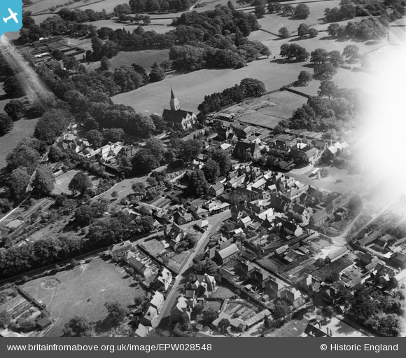
EPW028548 ENGLAND (1929). All Saints' Church and the town centre, Hawkhurst, 1929. This image has been affected by flare.
© Copyright OpenStreetMap contributors and licensed by the OpenStreetMap Foundation. 2025. Cartography is licensed as CC BY-SA.
Nearby Images (3)
EPW028548

EPW028544

EPW028545

Details
| Title | [EPW028548] All Saints' Church and the town centre, Hawkhurst, 1929. This image has been affected by flare. |
| Reference | EPW028548 |
| Date | August-1929 |
| Link | |
| Place name | HAWKHURST |
| Parish | HAWKHURST |
| District | |
| Country | ENGLAND |
| Easting / Northing | 576112, 130589 |
| Longitude / Latitude | 0.51275731935514, 51.047079006131 |
| National Grid Reference | TQ761306 |
Pins
Be the first to add a comment to this image!