
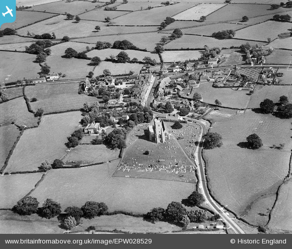
EPW028529 ENGLAND (1929). All Saints' Church and the village, Biddenden, 1929
© Copyright OpenStreetMap contributors and licensed by the OpenStreetMap Foundation. 2026. Cartography is licensed as CC BY-SA.
Nearby Images (6)
EPW028529

EPW028532

EPW028533

EPW028531

EPW028534

EPW028530

Details
| Title | [EPW028529] All Saints' Church and the village, Biddenden, 1929 |
| Reference | EPW028529 |
| Date | August-1929 |
| Link | |
| Place name | BIDDENDEN |
| Parish | BIDDENDEN |
| District | |
| Country | ENGLAND |
| Easting / Northing | 584957, 138425 |
| Longitude / Latitude | 0.64282785907849, 51.114694494821 |
| National Grid Reference | TQ850384 |
Pins

Railway Routes |
Thursday 31st of August 2023 09:40:47 PM |