
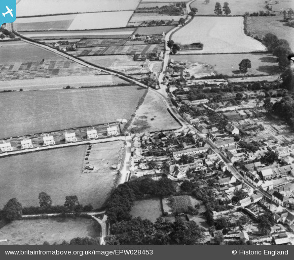
EPW028453 ENGLAND (1929). The High Street by the junction of Bartlow Road and Horseheath Road, Linton, 1929. This image has been produced from a copy-negative.
© Copyright OpenStreetMap contributors and licensed by the OpenStreetMap Foundation. 2026. Cartography is licensed as CC BY-SA.
Nearby Images (3)
EPW028453

EPW028447

EPW028445

Details
| Title | [EPW028453] The High Street by the junction of Bartlow Road and Horseheath Road, Linton, 1929. This image has been produced from a copy-negative. |
| Reference | EPW028453 |
| Date | August-1929 |
| Link | |
| Place name | LINTON |
| Parish | LINTON |
| District | |
| Country | ENGLAND |
| Easting / Northing | 556581, 246853 |
| Longitude / Latitude | 0.28617427528369, 52.097413614035 |
| National Grid Reference | TL566469 |
Pins
Be the first to add a comment to this image!