
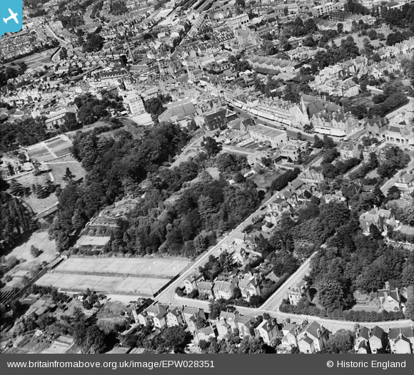
EPW028351 ENGLAND (1929). Church House Gardens and the town centre, Bromley, 1929
© Copyright OpenStreetMap contributors and licensed by the OpenStreetMap Foundation. 2026. Cartography is licensed as CC BY-SA.
Nearby Images (2)
EPW028351

EPW028344

Details
| Title | [EPW028351] Church House Gardens and the town centre, Bromley, 1929 |
| Reference | EPW028351 |
| Date | August-1929 |
| Link | |
| Place name | BROMLEY |
| Parish | |
| District | |
| Country | ENGLAND |
| Easting / Northing | 540195, 168995 |
| Longitude / Latitude | 0.015702058110065, 51.402140803751 |
| National Grid Reference | TQ402690 |
Pins
 |

Paul1867 |
Tuesday 28th of July 2026 01:52:05 PM |
|
London Lad |
Monday 10th of February 2014 12:39:09 PM | |
Now renovated and a members club, bar, restaurant and cafe |
Scott |
Thursday 26th of February 2026 06:15:06 PM |
|
London Lad |
Monday 10th of February 2014 12:35:10 PM | |
|
London Lad |
Monday 10th of February 2014 12:34:33 PM | |
|
London Lad |
Monday 10th of February 2014 12:33:43 PM | |
|
London Lad |
Monday 10th of February 2014 12:32:20 PM |