
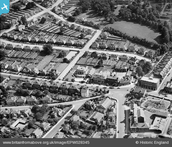
EPW028345 ENGLAND (1929). Widmore Road and First Church of Christ Scientist, Bromley, 1929
© Copyright OpenStreetMap contributors and licensed by the OpenStreetMap Foundation. 2026. Cartography is licensed as CC BY-SA.
Nearby Images (3)
EPW028345

EPW028347

EPW028349

Details
| Title | [EPW028345] Widmore Road and First Church of Christ Scientist, Bromley, 1929 |
| Reference | EPW028345 |
| Date | August-1929 |
| Link | |
| Place name | BROMLEY |
| Parish | |
| District | |
| Country | ENGLAND |
| Easting / Northing | 540590, 169405 |
| Longitude / Latitude | 0.021540028856658, 51.405727712437 |
| National Grid Reference | TQ406694 |
