
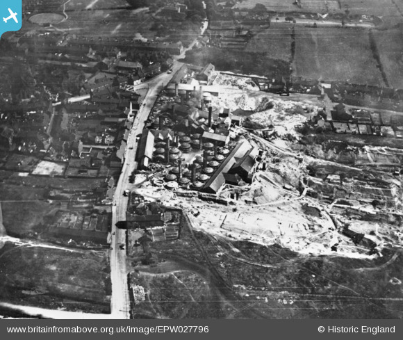
EPW027796 ENGLAND (1929). The Chesterton Tilery, Chesterton, 1929. this image has been produced from a copy-negative.
© Copyright OpenStreetMap contributors and licensed by the OpenStreetMap Foundation. 2026. Cartography is licensed as CC BY-SA.
Nearby Images (9)
EPW027796

EPW038503

EPW027991

EPW038506

EPW038507

EPW027993

EPW038505

EPW027992

EPW038504

Details
| Title | [EPW027796] The Chesterton Tilery, Chesterton, 1929. this image has been produced from a copy-negative. |
| Reference | EPW027796 |
| Date | June-1929 |
| Link | |
| Place name | CHESTERTON |
| Parish | |
| District | |
| Country | ENGLAND |
| Easting / Northing | 382945, 349436 |
| Longitude / Latitude | -2.2544030055625, 53.041619205168 |
| National Grid Reference | SJ829494 |
Pins
Be the first to add a comment to this image!