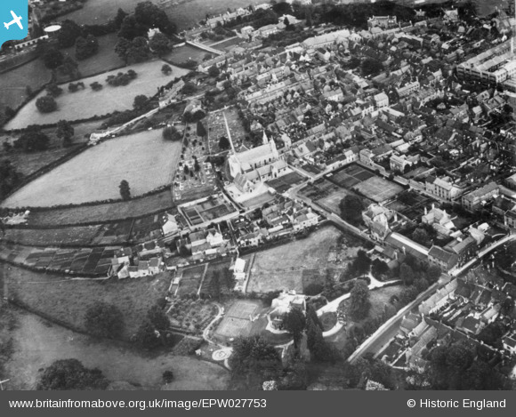
EPW027753 ENGLAND (1929). Holy Trinity Church and environs, Frome, 1929. This image has been produced from a copy-negative.
© Copyright OpenStreetMap contributors and licensed by the OpenStreetMap Foundation. 2026. Cartography is licensed as CC BY-SA.
Nearby Images (3)
EPW027753

EPW011065

EPW033182

Details
| Title | [EPW027753] Holy Trinity Church and environs, Frome, 1929. This image has been produced from a copy-negative. |
| Reference | EPW027753 |
| Date | 21-June-1929 |
| Link | |
| Place name | FROME |
| Parish | FROME |
| District | |
| Country | ENGLAND |
| Easting / Northing | 377158, 148346 |
| Longitude / Latitude | -2.3272010176787, 51.233326816619 |
| National Grid Reference | ST772483 |
Pins

Minerva Stone Conservation Ltd |
Friday 22nd of April 2016 05:00:06 PM | |

Class31 |
Tuesday 4th of November 2014 09:13:05 AM | |
|
Class31 |
Tuesday 4th of November 2014 09:11:18 AM |