
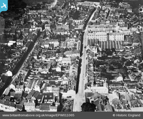
EPW011065 ENGLAND (1924). Selwood Road, Frome, 1924. This image has been produced from a copy-negative.
© Copyright OpenStreetMap contributors and licensed by the OpenStreetMap Foundation. 2026. Cartography is licensed as CC BY-SA.
Nearby Images (4)
EPW011065

EPW033182

EPW027746

EPW027753

Details
| Title | [EPW011065] Selwood Road, Frome, 1924. This image has been produced from a copy-negative. |
| Reference | EPW011065 |
| Date | July-1924 |
| Link | |
| Place name | FROME |
| Parish | FROME |
| District | |
| Country | ENGLAND |
| Easting / Northing | 377224, 148167 |
| Longitude / Latitude | -2.3262442313891, 51.231719749312 |
| National Grid Reference | ST772482 |
Pins

Class31 |
Monday 20th of October 2014 04:59:24 PM |
User Comment Contributions

Frome from the air looking north, 29/06/2014. Courtesy Con Shields |
Class31 |
Wednesday 5th of August 2015 11:32:27 AM |